Rethinking WebGIS
Rethinking WebGIS
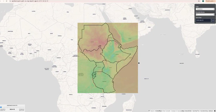
The blog from Development Seed on eoAPI for humanitarian use shows how modern technology can make satellite and earth observation data much easier to use. The post explains that many organizations working on disaster and risk management face a common problem: the data is available but very hard to access, slow to process, or locked inside complicated formats. The eoAPI approach solves this by giving a direct and frictionless way to work with large datasets through simple web services. Tools like TiTiler through eoAPI and WebGL maps by WeatherLayerGL allow users to view, filter, and stream only the part of the data they need, instead of downloading everything.
For our work in East Africa, this makes a strong case for improved data access for risk assessment. Hazard and impact models need quick and reliable inputs from satellite observations. By using eoAPI, we can connect different sources in a single system and reduce the technical barrier for local institutions. This also supports co-production, where scientists, decision makers, and communities can interact with the same data in real time. Frictionless datasets, powered by eoAPI, make it possible to move from raw satellite images to practical information for drought, flood, and other disaster risk assessment.
This shows a shift from traditional WebGIS to a new generation of web-native data services, where access, speed, and openness matter more than heavy custom systems.